Imagine your phone’s GPS suddenly showing a new coffee shop in the middle of the ocean, or a whole new neighborhood appearing on your digital map that no one had ever seen. You’d probably just laugh it off as a glitch. But for hundreds of years, maps weren’t just lines on a screen; they were seen as the absolute truth. The surprising fact is, many early maps were full of places that simply didn’t exist. So, how did these made-up lands end up on what people believed were the definitive guides to the world?
The answer involves a fascinating mix of human cleverness, huge challenges, and simple, understandable mistakes. Here’s what happened: Early mapmakers, especially from the time of great exploration through the early modern period, were trying to solve a giant puzzle with almost no instructions. They faced problems that are hard for us to even imagine today. These problems led to errors that, once drawn on parchment, could become accepted facts and take on a life of their own.
What Made Early Maps So Hard to Get Right?
Picture a navigator on a small wooden ship, battling huge waves, with only the sun and stars to guide them. Unlike today, there were no satellites or accurate clocks. Finding your north-south position (called latitude) was fairly easy using the sun or certain stars. But figuring out your east-west position (longitude) was a massive problem. It was a bit like knowing you’re on a specific street but having no idea what house number you’re at. Sailors might write down seeing land, but without exact longitude, its spot on a map could be wildly wrong or even completely incorrect.
Beyond navigation, mapmakers heavily relied on stories from other people. Think of it like a global game of “telephone.” Explorers would come back with tales, often exaggerated, about strange lands or faraway shores. Sometimes, these stories were based on real sightings. But other times, they came from fog banks mistaken for solid ground, unusual cloud formations, or even floating icebergs that looked like land. A tired sailor, after months at sea, might truly believe they saw an island, and their word was often the only “proof” available.
Gerhard Mercator, one of the most famous mapmakers of the 16th century, created maps that were revolutionary for his time. But even he had to deal with conflicting reports and the need to fill in blank spaces. Old records tell us that mapmakers often had to choose between many different, sometimes contradictory, descriptions from various expeditions. It wasn’t always about trying to trick anyone; it was about making the best guess with limited and often untrustworthy information.
This brings us to the ‘simple map error’ itself. Imagine a sailor spots what looks like land on the horizon. Perhaps it’s a mirage, a temporary volcanic island, or even just a particularly stubborn cloud bank. They mark it in their logbook. When this log reaches a mapmaker, perhaps months or years later, that blurry entry becomes a solid dot on a map. Then, other mapmakers, seeing this new landmass on a reputable chart, would simply copy it onto their own maps, assuming it was real. It’s like a rumor going viral before the internet; once it’s out there, it’s hard to stop.
“The sea is full of monsters and new lands, but sometimes the monsters are our fears, and the lands are our hopes.”
This natural process of copying, combined with the technology limits of the time, meant that a single, innocent mistake could be copied across countless maps. This made a non-existent island seem incredibly real. It became part of what everyone accepted as geographical knowledge, even if no later expedition could ever find it again. What makes this so fascinating is how easily a momentary illusion or a slight miscalculation could become a permanent feature on the world’s most official documents.
These early map errors weren’t just curious stories; they shaped how people explored, guided voyages, and even influenced who claimed new lands for centuries. They remind us that even our most trusted information sources can have hidden origins in human mistakes and the incredible challenges of exploring the unknown. Next, we’ll dive into how one particular map error took root and blossomed into the enduring legend of a mythical island paradise.
How Did a Simple Map Mistake Turn into a Believable Island Paradise?

Imagine a typo on a digital map today – maybe a misspelled street name – that somehow got copied by every GPS system, every delivery service, and even official government maps for hundreds of years. Sounds crazy, right? But that’s exactly what happened with certain “phantom islands” throughout history. What’s truly fascinating is how a tiny mistake, like a smudged ink spot or a wrongly placed dot, didn’t just stick around; it grew into a widely believed, and often desperately searched-for, mythical land. The real reason? A powerful blend of human hope, the desire for wealth, and a world that was still mostly a huge mystery.
So, here’s how it unfolded: once that first, simple mistake appeared on an early map, it was like a tiny seed. Early map-makers, also known as cartographers, didn’t often have the time or tools to properly survey new areas. They frequently copied from older, respected maps, simply trusting that earlier maps were correct. Imagine a game of telephone, but with maps across hundreds of years. If an important map from, say, the 14th or 15th century, showed a piece of land, later map-makers would carefully copy it. This wasn’t about checking if it was real; it was about collecting and reproducing what everyone believed to be true. So, the mistaken island, maybe just a tiny dot at first, would pop up on map after map, looking clearer and seeming more real with every copy.
How Did These Phantom Islands Become So Believable?
When these islands kept showing up, sometimes for hundreds of years, they started to feel incredibly real. It’s like hearing a story repeated across many news channels today; you just start to think, “It must be true if everyone’s reporting it!” During the age of exploration, maps were more than just tools for finding your way. They were seen as proof of knowledge, a guide to the unknown. So, when explorers sailed west and their map showed land hundreds of miles away, they fully expected to discover it. History shows us that nobody really questioned these maps, and it was incredibly hard to check facts across huge, unknown oceans. This made it easy for these made-up map stories, often called phantom islands, to really take hold. They weren’t just dots on a page; they were promises.
Even famous explorers like Juan de la Cosa, a Spanish map-maker whose 1500 world map was one of the first to show Columbus’s discoveries, still included many legendary islands. He wasn’t trying to trick anyone; he was simply showing what people generally knew and believed at that time, often mixing old legends with new findings. The massive amount of unknown territory also played a huge part. Imagine a period when whole continents were being “discovered” – the thought of finding a few more islands out there seemed totally possible, even likely.
Why Did People Want to Believe in These Island Paradises So Much?
The real reason is more interesting than you might guess. It wasn’t just about copying maps; people truly wanted these islands to be real, especially if they were described as perfect places. Why? For a few powerful reasons:
-
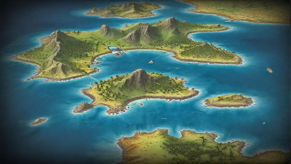
The Dream of a Perfect Place: Throughout history and across different cultures, people have always dreamed of perfect places – safe spots free from war, sickness, or tough times. Ancient myths like Plato’s Atlantis or stories of the Garden of Eden were well-known and believed by many. An undiscovered island was the perfect place to imagine these dreams coming true. Explorers weren’t just seeking land; they were often looking for new beginnings, a fresh start.
-
Hidden Resources & Riches: During the Age of Exploration, Europe was desperate for gold, spices, and new trade routes. An “undiscovered” island meant hidden riches – forests for wood, rich soil for crops, and precious metals just waiting to be dug up. Business owners and governments didn’t see these phantom islands as mistakes; they saw them as potential goldmines, worth sending expensive trips to find. Think of it like a rumored, untouched oil field today; just the promise of it can lead to huge investments.
-
The Thrill of the Unknown: The huge, unexplored oceans were completely unknown. Sailors often told tales of sea monsters, mermaids, and weird weather. In such a mysterious world, the idea of a beautiful, hidden island wasn’t just believable; it was almost expected. The empty spaces on maps weren’t just filled with mistakes, but with hopes and fears.
This idea was so strong that explorers like Ferdinand Magellan, as he got ready for his famous trip around the world, would have carefully studied maps showing not just known places, but also these imagined islands. Powerful countries like Spain and Portugal, big players in exploring the world, would pay for voyages with clear orders to specifically look for these promised lands. These instructions often described them as having plenty of fresh water, pleasant weather, and gentle, perhaps even friendly, people – making them sound even more like paradise.
So, believing in these islands wasn’t just a weird old story from history; it actually changed how exploration happened. It influenced travel paths, used up money and supplies, and pushed men to sail into truly unknown parts of the ocean. What makes this surprising is how a tiny, almost insignificant mistake could become so important, turning into a source of hope and a big reason for people to keep trying. Next, we’ll dive into what happened when these expeditions finally arrived at where these phantom islands were supposed to be.
How Was the Myth of the Fabled Island Paradise Finally Debunked?

Imagine looking at an old map today and seeing a huge, mysterious island labeled ‘Paradise Island’ – but you know it isn’t really there. For centuries, that’s exactly what happened with our famous ‘Paradise Island,’ a place born from a simple map mistake. So, how did people finally realize this legendary spot was just a beautiful dream? It wasn’t one big moment, but rather a long story of tireless exploration, many disappointments, and some amazing scientific breakthroughs. This mythical island finally disappeared from our maps and our minds because brave explorers kept searching, and new inventions helped map the world far more accurately.
For hundreds of years, the promise of this hard-to-find paradise sent countless expeditions sailing across huge, unknown oceans. Explorers, believing legends and hoping for unimaginable wealth or a perfect, peaceful home, would set sail with old, often inaccurate maps. Their crews were full of ambition! Their methods were simple: they followed known routes, dared to explore unknown waters, and used the sun and stars to guess where they were. But the ocean was vast, and they had a poor grasp of ‘latitude’ (how far north or south they were) and even worse ways to measure ‘longitude’ (how far east or west). This meant they often got lost, sailing right past where the island might have been, or even searching in the wrong part of the world entirely. Imagine trying to find a specific house in a giant city, but your map only has vague neighborhood names and no street numbers, and you can only travel by horse and buggy! Their challenges were huge: terrible storms, widespread disease, dwindling supplies, and the heartbreaking despair of never finding their goal. Each trip that found nothing slowly chipped away at the myth, making mapmakers back home start to wonder.
How Did We Finally Get the Real Picture?
The real turning point wasn’t just about sending more ships or bolder captains; it was about amazing new technology. The biggest change came in the 18th century with the invention of the chronometer, a super-accurate clock. Before this clock, sailors couldn’t precisely figure out their longitude – that’s how far east or west they were. This meant their positions on maps were often off by hundreds of miles! But with the chronometer, explorers like Captain James Cook could, for the first time, map coastlines and islands with amazing accuracy. Cook was a brilliant navigator. He carefully sailed through huge parts of the Pacific and Atlantic oceans, proving again and again that many rumored islands simply didn’t exist. His careful surveys, using the chronometer along with better ways to navigate by the stars, started to create a truly accurate map of the world.
As time went on, ways to survey and map land improved a lot, especially near coastlines. Governments and scientific groups started dedicated mapping missions. These weren’t just random exploration trips; instead of hunting for myths, they needed reliable maps for things like trade and defending their borders. Think of it like a modern GPS system finally replacing ancient, hand-drawn road maps. These new, precise tools and methods slowly pushed the mythical island right off the map. If a well-equipped team sailed exactly where the island was supposed to be and found only open water, it became harder and harder to keep it on official maps.
The real end came in the late 1700s and early 1800s. By then, many well-equipped naval expeditions, carrying chronometers and much better mapping tools, kept reporting the same thing: no land where the fabled island should have been. For example, the French explorer Louis Antoine de Bougainville, just like Cook, carefully mapped huge areas of the ocean. When his detailed maps showed only water where the island was supposed to be, scientists began to seriously doubt the myth. The repeated failure to find it, combined with solid proof of open water, finally led to the island being slowly removed from world maps by the early 1800s. It wasn’t a single big discovery, but rather the combined impact of many failed searches and increasingly accurate maps that finally made the legend disappear.
Still, even as it vanished from maps, this mythical island left a lasting impact. It sparked centuries of exploration, pushing people to search for the unknown and vastly improving how we navigate and make maps. It inspired countless stories, poems, and artworks, becoming deeply ingrained in our shared imagination as a symbol of a dream that can’t quite be reached. Even today, these phantom islands remind us that while maps show us a mostly known world, our human desire for discovery and the appeal of the unknown will always remain strong. And in a way, that endless curiosity is a paradise all its own. Next, we’ll explore how these disappearing lands changed our understanding of history and the very art of map-making.