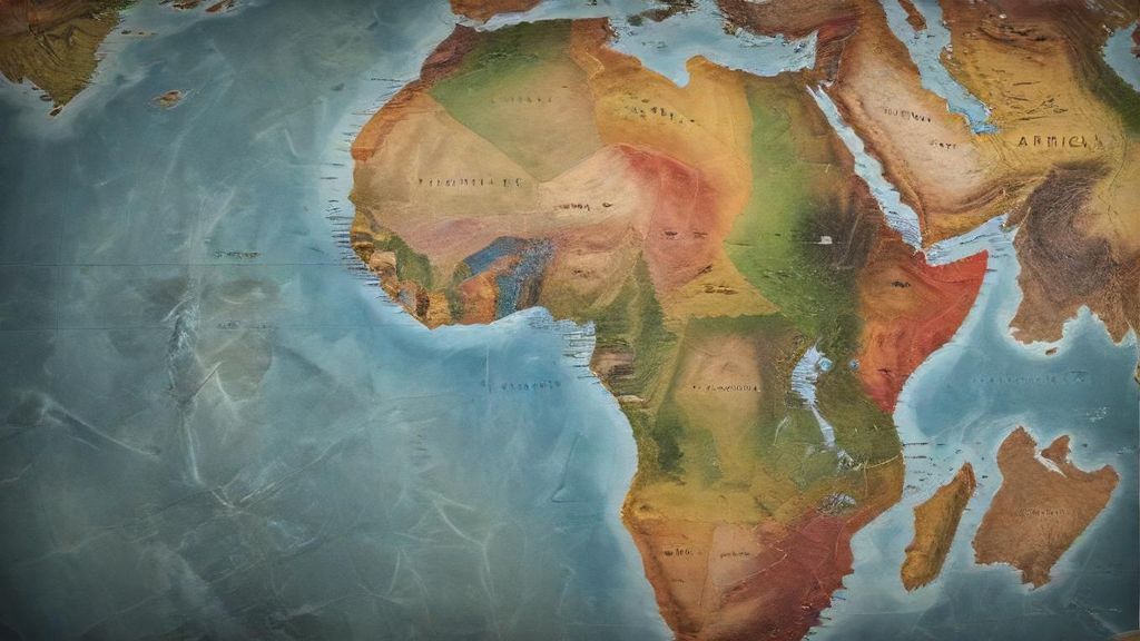
When most people think of Africa before European colonization, they might imagine empty lands or small, isolated tribes. But here’s what we’ve learned: the truth is much more exciting than that. Before European powers started dividing up the continent, Africa was far from an empty space. Instead, it was a lively mix of advanced societies, busy trade routes, and incredibly diverse cultures, much like the complex, interconnected world we see today.
Picture this: a huge continent with hundreds, maybe even thousands, of distinct ethnic and language groups. These weren’t just small, scattered groups of people; many were flourishing kingdoms and empires with well-organized governments and strong economies. Think of the famous Mali Empire in West Africa, which thrived from the 13th to 16th centuries. It was known for its vast gold wealth and its smart centers like Timbuktu. This city wasn’t just a sandy outpost; it was a major hub for learning, with universities and libraries that attracted scholars from all over the known world – much like a Silicon Valley for ancient knowledge.
Or consider the amazing stone city of Great Zimbabwe in Southern Africa, built between the 11th and 15th centuries by the Shona people. Its huge stone walls, built without any mortar, are strong proof of a powerful and rich civilization. Digs show they built their cities cleverly and traded far and wide, not just with nearby places but all the way to China. These were massive building projects that stood tall against anything being built in Europe at the same time.
The continent was crisscrossed by established trade routes that worked like ancient supply chains or even early internet networks, connecting communities far and wide. The Trans-Saharan trade route, for example, moved incredible wealth – gold, salt, kola nuts, and other goods – linking West African kingdoms with North Africa, the Middle East, and beyond. Along the East African coast, Swahili city-states like Kilwa and Mombasa were big players in the Indian Ocean trade, swapping ivory, spices, and textiles with merchants from Arabia, Persia, and India. These routes weren’t just for goods; they were pathways for ideas, religions, and new technologies, showing how truly connected Africa was.
What Drew Europeans to Africa?
So, if Africa was already so vibrant and organized, why did European interest suddenly explode? The answer lies in a mix of strong economic, political, and strategic reasons that began to build up in Europe during the 19th century. Imagine a world where European nations were constantly battling each other, like rival companies trying to dominate the market.
One main reason was purely economic. Europe’s Industrial Revolution made factories hungry for raw materials – things like rubber, palm oil, cotton, and different minerals to keep them running. Africa was seen as an untouched storehouse of these resources. On top of that, these industrial powerhouses needed new places to sell their finished products. To put it simply, Africa offered both the ingredients and the potential customers for Europe’s growing industries.
Politically, taking control of land in Africa became a huge symbol of a nation’s importance and power. Owning colonies was like having the best properties in a global competition; it really boosted a country’s standing in the world. As European countries fought for position, each wanted to claim as much land as possible to get ahead of their rivals. This fierce competition was like a high-stakes game of Monopoly, with the continent of Africa as the board.
Strategically, controlling certain coastal areas or access points to rivers inside the continent could offer military advantages or secure crucial trade routes. For example, controlling the Suez Canal or key ports meant easier access to profitable Asian markets. Recent discoveries show that European explorers and missionaries, often seen as pioneers, also helped by gathering important information about Africa’s geography and resources, which cleared the way for eventual military takeovers.
Historical records tell us that as European ambitions grew, they started to view Africa’s existing complex societies and borders – which had been shaped over centuries – only through the lens of their own self-interest. This growing interest, driven by greed and geopolitical rivalry, set the stage for the dramatic and devastating “Scramble for Africa,” which we’ll explore in the next chapter. It’s here that we begin to see the tragic unraveling of a continent’s natural development.
What was the biggest mistake Europeans made when dividing Africa at the Berlin Conference?
Imagine powerful strangers meeting in a grand conference room, thousands of miles away, and deciding to redraw the map of your entire continent. They hadn’t seen most of the places, couldn’t speak the languages, and certainly didn’t ask the people who lived there what they thought. Then, with just pencils and rulers, they simply carved up your homeland into new countries, effectively deciding your future for you.
That’s essentially what happened to Africa at the Berlin Conference of 1884-1885. The biggest mistake Europeans made wasn’t just dividing Africa; it was doing so without caring about the people already living there. The simple answer is this: they drew borders that split up close-knit communities, forced rival groups to live together, and cut through old trade routes, all to serve their own goals for more land and power.
How Did They Get Away With It?
The truth is more interesting than you might think. By the late 1800s, European powers were in a frantic race, often called the “Scramble for Africa,” to claim land and resources. Everyone wanted a piece of the continent’s huge mineral wealth, rich farming lands, and important rivers and sea routes. To avoid a big war among themselves, German Chancellor Otto von Bismarck called a conference in Berlin. The idea was to set some “rules” for claiming land, but what actually happened was much worse.
Here’s what happened: representatives from 14 European nations gathered around a huge map of Africa. Not a single African leader or representative was invited or even asked for their opinion. Think of it like a board meeting where the future of an entire company is decided, but none of the actual employees are in the room. What makes this fascinating, and deeply disturbing, is the pure nerve of this act. They treated Africa as an empty space, a blank canvas for them to draw their empires on.
The conference came up with a rule called “effective occupation.” This meant that to claim a territory, a European power had to actually set up some kind of government presence, like a fort or a trading post. But the lines they drew on maps back in Berlin, often straight as a ruler, had little to do with the complicated ways people lived and where they were on the ground. For example, the conference sealed the fate of the huge Congo Basin, essentially giving it over to King Leopold II of Belgium as his own personal property. This led to horrific cruelty no one could have imagined.
The evidence shows that these lines were drawn based on European claims, the path of big rivers like the Niger and Congo (which made trade and transport easy), and sometimes just what was easiest for colonial bosses. They cared most about getting resources – things like rubber, diamonds, and minerals – and making it easy to move things, like having access to ports.
According to historian Basil Davidson, the conference “legitimized the partition of Africa, regardless of African interests.”
The borders cut across hundreds of different ethnic and language groups, creating countries that hadn’t existed before.
This huge mistake created a mix of states that ended up with serious, long-lasting problems. Entire groups like the Maasai were split between two different colonies, while groups that had always been enemies were forced together under one colonial government. It’s like trying to build a new house by randomly combining rooms from different old houses, completely ignoring how people actually live in them.
You can still see today that some of these straight lines are on modern maps, a clear reminder of how randomly they were made. These borders, created without local input, became the main problem in Africa’s political layout, leading to future problems and wars after countries gained their freedom. This makes us wonder how these lines, drawn so quickly, managed to last.
How did arbitrarily drawn borders lead to so many conflicts in modern Africa?
Imagine trying to build a strong house on a foundation made of shifting sand. That’s a bit like what happened in Africa after independence. The answer to why these made-up borders caused so much trouble lies directly in how they were created. European powers drew these lines in the 19th century, cutting through communities, throwing rival groups together, and completely ignoring the deep connections people had for hundreds of years. The immediate result was a continent struggling with an impossible job: trying to build single countries from many different groups who often had nothing in common. This directly led to the widespread conflicts and instability we still see today. This chapter will uncover how this ‘mistake’ became a lasting wound.
Here’s what we discovered: European leaders simply drew lines across Africa without caring about the different cultures or groups already living there. Think of it this way: what if America was just randomly cut up, putting Californians under the rule of New Yorkers, and splitting families across brand-new, nonsensical state lines? This happened all over Africa. When independence finally came in the mid-20th century, the new African nations got stuck with these strange, impractical borders. Ethnic conflicts often exploded because groups who had been historic rivals were suddenly forced into one country, competing for resources and political power. Meanwhile, groups who spoke the same language and shared a culture were split across several nations, weakening their collective identity and influence. The truth is more interesting than you might think: these weren’t just lines on a map; they were deeply felt divisions that tore societies apart.
The Rwandan Genocide in 1994, for example, is a chilling case. While the roots of the conflict are complex, the colonial powers—first Germany, then Belgium—played a crucial role. They made the differences between the Hutu and Tutsi groups even stronger. They gave Tutsis more power in government jobs and even created identity cards that highlighted these differences. According to historians like Gérard Prunier, this colonial policy deepened ethnic divisions, which then exploded into terrible violence after independence. It’s like a parent constantly telling two siblings one is better than the other, then leaving them alone in a house after years of simmering resentment. Similarly, in Nigeria, the British threw together hundreds of different ethnic groups, including the major Hausa-Fulani, Igbo, and Yoruba. This created a country that was very diverse but also often unstable, leading to the devastating Biafran War in the late 1960s.
How did these borders affect nation-building?
What makes this fascinating is how these imposed boundaries made it almost impossible for new countries to create a shared sense of ‘us’ or national pride. Instead of feeling loyal to the nation, people often felt a stronger bond to their own ethnic group. This led to huge political instability and weak governments. It showed up in many coups (where one group suddenly takes power), civil wars, and constant fighting between different groups for control. We know this because historical records tell us that many post-colonial leaders struggled immensely to unite their diverse populations under a single banner.
Think about the constant struggles in places like Sudan, which eventually split into two countries in 2011. The arbitrary borders had forced the largely Arab and Muslim north together with the mostly African, Christian, and animist south. The result was decades of civil war and immense human suffering, all because colonial powers decided to force very different peoples together into one made-up country. It’s like trying to force two completely different companies with opposing cultures and goals to merge without any common ground – it’s bound to end in disaster.
Beyond conflict, the arbitrary borders also held back their economies. Colonial powers drew lines that often blocked natural trade routes, separated communities from their traditional farmlands, or put valuable resources far from where they could be used. Imagine if crucial parts of a company’s supply chain were suddenly divided by a new national border, making trade and cooperation a nightmare. This splitting up of economies and markets made it really tough for these new countries to build strong, connected economic systems. Recent findings reveal that the lack of regional teamwork on the economy, a direct result of these borders, still slows down growth and success all over Africa today.
The truth is, the problems caused by these borders still affect Africa today. They make it hard to govern, keep people safe, and grow the economy. The ‘mistake’ of the 19th century wasn’t just a geographical error; it was a deeply human one. It affected millions of lives and created many of the biggest problems Africa faces even now. But how did these newly independent nations try to overcome such a monumental and damaging inheritance? That’s what we’ll explore next.